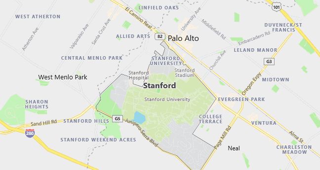
Moving to Stanford, California
Population: 13,315
Males: 7,206 (54.1%), Females: 6,109 (45.9%)
Santa Clara County
Zip code: 94305
Demographics
Median resident age: 22.1 years
Median household income: $41,106
Median house value: $870,800
Population by Race
Races in Stanford:
- White Non-Hispanic (56.0%)
- Chinese (13.1%)
- Hispanic (9.0%)
- Black (4.9%)
- Two or more races (4.6%)
- Asian Indian (4.5%)
- Other race (3.7%)
- Korean (3.6%)
- Other Asian (2.0%)
- Japanese (1.5%)
- American Indian (1.4%)
(Total can be greater than 100% because Hispanics could be counted in other races)
Ancestries: German (10.2%), English (8.7%), Irish (7.3%), Italian (4.2%), Russian (3.3%), Polish (2.9%).
Elevation: 95 feet
Land area: 2.7 square miles
Population by Education
For population 25 years and over in Stanford
- High school or higher: 99.1%
- Bachelor’s degree or higher: 94.6%
- Graduate or professional degree: 64.9%
- Unemployed: 14.1%
- Mean travel time to work: 12.7 minutes
For population 15 years and over in Stanford CDP
- Never married: 68.9%
- Now married: 28.3%
- Separated: 0.4%
- Widowed: 1.2%
- Divorced: 1.1%
25.2% Foreign born (15.1% Asia, 4.7% Europe).
Hospitals
Hospital/medical center in Stanford:
- STANFORD HOSPITAL (300 PASTEUR DRIVE)
Other hospitals/medical centers near Stanford:
- LUCILE SALTER PACKARD CHILDREN’S HSP (about 2 miles; PALO ALTO, CA)
- RECOVERY INN OF MENLO PARK (about 3 miles; MENLO PARK, CA)
- KAISER FOUNDATION HOSPITAL (about 6 miles; REDWOOD CITY, CA)
Airports
Airports certified for carrier operations nearest to Stanford:
- NORMAN Y. MINETA SAN JOSE INTERNATIONAL (about 18 miles; SAN JOSE, CA; Abbreviation: SJC)
- SAN FRANCISCO INTERNATIONAL (about 20 miles; SAN FRANCISCO, CA; Abbreviation: SFO)
- METROPOLITAN OAKLAND INTL (about 21 miles; OAKLAND, CA; Abbreviation: OAK)
Other public-use airports nearest to Stanford:
- PALO ALTO ARPT OF SANTA CLARA CO (about 5 miles; PALO ALTO, CA; Abbreviation: PAO)
- SAN CARLOS (about 8 miles; SAN CARLOS, CA; Abbreviation: SQL)
- HAYWARD EXECUTIVE (about 16 miles; HAYWARD, CA; Abbreviation: HWD)
Amtrak stations near Stanford:
- 15 miles: FREMONT (CENTERVILLE, FREMONT & PERALTA BLVDS.). Services: fully wheelchair accessible, enclosed waiting area, public restrooms, public payphones, snack bar, free short-term parking, free long-term parking, call for car rental service, call for taxi service, public transit connection.
- 16 miles: SANTA CLARA-GREAT AMERICA (SANTA CLARA, FOOT OF STARS & STRIPES DR.). Services: partially wheelchair accessible, free short-term parking.
- 18 miles: HAYWARD (22555 MEEKLAND AVE.). Services: fully wheelchair accessible, public payphones, free short-term parking.
Colleges and Universities
College/University in Stanford:
- STANFORD UNIVERSITY (Full-time enrollment: 14,955; Private, not-for-profit; Website: WWW.STANFORD.EDU/; Offers Doctor’s degree)
Other colleges/universities with over 2000 students near Stanford:
- FOOTHILL COLLEGE (about 5 miles; LOS ALTOS HILLS, CA; Full-time enrollment: 7,415)
- CANADA COLLEGE (about 6 miles; REDWOOD CITY, CA; Full-time enrollment: 2,438)
- DE ANZA COLLEGE (about 11 miles; CUPERTINO, CA; Full-time enrollment: 13,197)
- COLLEGE OF SAN MATEO (about 15 miles; SAN MATEO, CA; Full-time enrollment: 5,619)
- MISSION COLLEGE (about 15 miles; SANTA CLARA, CA; Full-time enrollment: 4,565)
- WEST VALLEY COLLEGE (about 15 miles; SARATOGA, CA; Full-time enrollment: 5,880)
- CHABOT COLLEGE (about 16 miles; HAYWARD, CA; Full-time enrollment: 6,852)
Public primary/middle schools in Stanford:
- ESCONDIDO ELEMENTARY (Students: 463; Location: 890 ESCONDIDO ROAD; Grades: KG – 05)
- NIXON (LUCILLE M.) ELEMENTARY (Students: 383; Location: 1711 STANFORD AVE.; Grades: KG – 05)