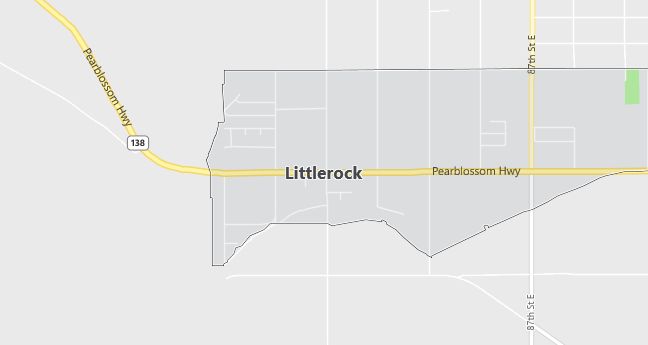
Moving to Littlerock, California
Population: 1,402
Males: 694 (49.5%), Females: 708 (50.5%)
Los Angeles County
Zip code: 93543
Demographics
Median resident age: 29.1 years
Median household income: $39,000
Median house value: $88,400
Population by Race
Races in Littlerock:
- White Non-Hispanic (54.1%)
- Hispanic (39.7%)
- Other race (19.8%)
- Black (4.8%)
- Two or more races (2.5%)
- American Indian (1.4%)
(Total can be greater than 100% because Hispanics could be counted in other races)
Ancestries: German (16.5%), Italian (12.1%), English (6.8%), Irish (5.8%), French (2.2%), United States (2.1%).
Elevation: 2830 feet
Land area: 1.4 square miles
Population by Education
For population 25 years and over in Littlerock
- High school or higher: 69.7%
- Bachelor’s degree or higher: 1.8%
- Graduate or professional degree: 1.1%
- Unemployed: 11.3%
- Mean travel time to work: 35.3 minutes
For population 15 years and over in Littlerock CDP
- Never married: 22.1%
- Now married: 67.9%
- Separated: 0.6%
- Widowed: 3.5%
- Divorced: 5.9%
11.1% Foreign born (6.9% Latin America, 3.9% Europe).
Hospitals
Hospitals/medical centers near Littlerock:
- ANTELOPE VALLEY HOSPITAL MED CENTER (about 17 miles; LANCASTER, CA)
- LAC/HIGH DESERT HOSPITAL (about 17 miles; LANCASTER, CA)
- LANCASTER COMMUNITY HOSPITAL (about 17 miles; LANCASTER, CA)
Airports
Airports certified for carrier operations nearest to Littlerock:
- PALMDALE PRODN FLT/TEST INSTLN AF PLANT 42 (about 10 miles; PALMDALE, CA; Abbreviation: PMD)
- EDWARDS AFB (about 27 miles; EDWARDS, CA; Abbreviation: EDW)
- BURBANK-GLENDALE-PASADENA (about 34 miles; BURBANK, CA; Abbreviation: BUR)
Other public-use airports nearest to Littlerock:
- GENERAL WM J FOX AIRFIELD (about 22 miles; LANCASTER, CA; Abbreviation: WJF)
- AGUA DULCE AIRPARK (about 22 miles; AGUA DULCE, CA; Abbreviation: L70)
- ROSAMOND SKYPARK (about 28 miles; ROSAMOND, CA; Abbreviation: L00)
Amtrak stations near Littlerock:
- 11 miles: PALMDALE (120 E. PALMDALE BLVD.) – Bus Station. Services: fully wheelchair accessible, public payphones, full-service food facilities, free short-term parking, call for taxi service.
- 16 miles: LANCASTER (44742 SIERRA HWY.) – Bus Station. Services: fully wheelchair accessible, enclosed waiting area, public restrooms, public payphones, free short-term parking, free long-term parking, taxi stand, public transit connection.
Colleges and Universities
Colleges/universities with over 2000 students nearest to Littlerock:
- ANTELOPE VALLEY COLLEGE (about 28 miles; LANCASTER, CA; Full-time enrollment: 5,308)
- AZUSA PACIFIC UNIVERSITY (about 28 miles; AZUSA, CA; Full-time enrollment: 5,285)
- PASADENA CITY COLLEGE (about 28 miles; PASADENA, CA; Full-time enrollment: 11,867)
- CITRUS COLLEGE (about 28 miles; GLENDORA, CA; Full-time enrollment: 6,830)
- GLENDALE COMMUNITY COLLEGE (about 29 miles; GLENDALE, CA; Full-time enrollment: 7,964)
- UNIVERSITY OF LA VERNE (about 32 miles; LA VERNE, CA; Full-time enrollment: 4,718)
- CALIFORNIA STATE UNIVERSITY-LOS ANGELES (about 34 miles; LOS ANGELES, CA; Full-time enrollment: 14,556)
Schools
Public high school in Littlerock:
- R. REX PARRIS HIGH SCHOOL (Students: 595; Location: 10833 E. AVENUE R; Grades: 09 – 12)
Public primary/middle schools in Littlerock:
- ALMONDALE MIDDLE (Students: 611; Location: 9330 E. AVENUE U; Grades: 07 – 08)
- ALPINE ELEMENTARY (Students: 540; Location: 8244 E PEARBLOSSOM HWY.; Grades: KG – 06)
- ANTELOPE ELEMENTARY (Students: 267; Location: 37237 N. 100TH ST., EAST; Grades: KG – 07)
- HEARNS (HENRY) CHARTER (Students: 75; Location: 37721 N. 100TH ST.; Grades: KG – 12)
Private primary/middle schools in Littlerock:
- SONSHINE CHRISTIAN SCHOOL (Students: 36; Location: 8533 EAST AVENUE T; Grades: PK – 5)
- DESERT BLOSSOM CHRISTIAN INSTI (Students: 30; Location: 37827 N 97TH ST E; Grades: PK – 8)