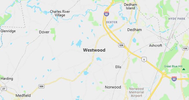
Moving to Westwood, Massachusetts
Population: 14,117. Estimated population in July 2024: 13,900 (-1.5% change)
Males: 6,714 (47.6%), Females: 7,403 (52.4%)
Norfolk County
Demographics
Median resident age: 41.0 years
Median household income: $87,394
Median house value: $360,600
Population by Race
Races in Westwood:
- White Non-Hispanic (95.3%)
- Chinese (1.0%)
- Hispanic (0.9%)
- Two or more races (0.8%)
- Asian Indian (0.5%)
Ancestries: Irish (33.6%), Italian (16.2%), English (13.7%), German (8.4%), Polish (4.0%), United States (3.7%).
Elevation: 220 feet
Population by Education
For population 25 years and over in Westwood
- High school or higher: 94.5%
- Bachelor’s degree or higher: 57.4%
- Graduate or professional degree: 23.9%
- Unemployed: 2.5%
- Mean travel time to work: 28.9 minutes
For population 15 years and over in Westwood town
- Never married: 18.0%
- Now married: 68.3%
- Separated: 0.8%
- Widowed: 8.5%
- Divorced: 4.4%
8.9% Foreign born (3.7% Europe, 3.4% Asia, 0.9% North America).
Hospitals
Hospital/medical center in Westwood:
- WESTWOOD PEMBROKE HEALTH SYSTEMS (45 CLAPBOARDTREE ST)
Other hospitals/medical centers near Westwood:
- CARITAS NORWOOD HOSPITAL, INC (about 3 miles; NORWOOD, MA)
- DEACONESS-GLOVER HOSPITAL CORP (about 6 miles; NEEDHAM, MA)
- MEDFIELD STATE HOSPITAL (about 6 miles; MEDFIELD, MA)
Airports
Airports certified for carrier operations nearest to Westwood:
- LAURENCE G HANSCOM FLD (about 18 miles; BEDFORD, MA; Abbreviation: BED)
- GENERAL EDWARD LAWRENCE LOGAN INTL (about 19 miles; BOSTON, MA; Abbreviation: BOS)
- THEODORE FRANCIS GREEN STATE (about 37 miles; PROVIDENCE, RI; Abbreviation: PVD)
Other public-use airports nearest to Westwood:
- NORWOOD MEMORIAL (about 5 miles; NORWOOD, MA; Abbreviation: OWD)
- NORFOLK (about 12 miles; NORFOLK, MA; Abbreviation: 32M)
- MANSFIELD MUNI (about 15 miles; MANSFIELD, MA; Abbreviation: 1B9)
Amtrak station:
ROUTE 128 (UNIVERSITY AVE. & RTE. 128). Services: ticket office, enclosed waiting area, public restrooms, public payphones, vending machines, paid short-term parking, taxi stand, public transit connection.
Colleges and Universities
College/University in Westwood:
- FUNERAL INSTITUTE OF THE NORTHEAST (Full-time enrollment: 27; Location: 77 UNIVERSITY AVE; Private, for-profit; Website: www.Tiac.net/users/Lynlou)
Colleges and Universities
Colleges/universities with over 2000 students nearest to Westwood:
- WELLESLEY COLLEGE (about 8 miles; WELLESLEY, MA; Full-time enrollment: 2,241)
- MASSACHUSETTS BAY COMMUNITY COLLEGE (about 8 miles; WELLESLEY HILLS, MA; Full-time enrollment: 2,938)
- BOSTON COLLEGE (about 9 miles; CHESTNUT HILL, MA; Full-time enrollment: 13,341)
- BABSON COLLEGE (about 10 miles; WELLESLEY, MA; Full-time enrollment: 2,659)
- BENTLEY COLLEGE (about 13 miles; WALTHAM, MA; Full-time enrollment: 4,651)
- BOSTON UNIVERSITY (about 13 miles; BOSTON, MA; Full-time enrollment: 25,110)
- BERKLEE COLLEGE OF MUSIC (about 13 miles; BOSTON, MA; Full-time enrollment: 3,122)
Schools
Public high school in Westwood:
- WESTWOOD HIGH (Students: 737; Location: 200 NAHATAN STREET; Grades: 09 – 12)
Private high school in Westwood:
- XAVERIAN BROS HIGH SCHOOL (Students: 863; Location: 800 CLAPBOARDTREE ST; Grades: 9 – 12; Boys only)
Public primary/middle schools in Westwood:
- E W THURSTON MIDDLE (Students: 650; Location: 850 HIGH STREET; Grades: 06 – 08)
- MARTHA JONES (Students: 353; Location: 80 MARTHA JONES RD; Grades: KG – 05)
- WILLIAM E SHEEHAN (Students: 330; Location: 549 POND; Grades: KG – 05)
- DOWNEY (Students: 291; Location: DOWNEY STREET; Grades: PK – 05)
- DEERFIELD SCHOOL (Students: 224; Location: 72 DEERFIELD AVENUE; Grades: KG – 05)
- PAUL HANLON (Students: 176; Location: 790 GAY STREET; Grades: KG – 05)
Libraries
Library in Westwood:
- WESTWOOD PUBLIC LIBRARY (Operating income: $780,424; Location: 668 HIGH ST.; 93,343 books; 3,009 audio materials; 2,870 video materials; 200 serial subscriptions)