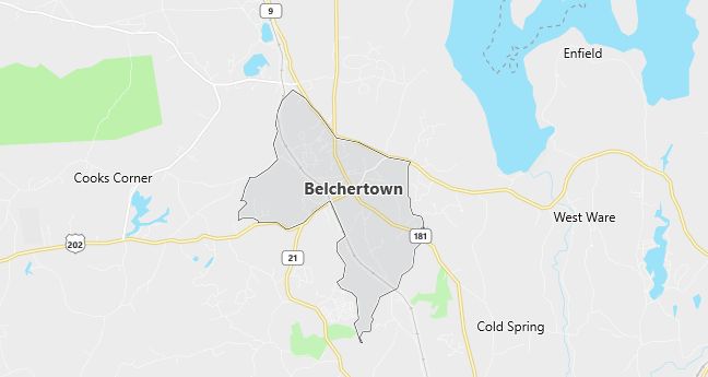
Moving to Belchertown, Massachusetts
Population: 12,968. Estimated population in July 2024: 13,958 (+7.6% change)
Males: 6,313 (48.7%), Females: 6,655 (51.3%)
Hampshire County
Demographics
Median resident age: 36.3 years
Median household income: $52,467
Median house value: $145,000
Population by Race
Races in Belchertown:
- White Non-Hispanic (95.3%)
- Hispanic (1.6%)
- Two or more races (1.3%)
- Black (0.8%)
- American Indian (0.8%)
- Other race (0.5%)
Ancestries: Irish (21.2%), French (18.0%), English (14.1%), Polish (13.8%), French Canadian (13.3%), Italian (9.7%).
Elevation: 613 feet
Land area: 5.0 square miles
Population by Education
For population 25 years and over in Belchertown
- High school or higher: 89.9%
- Bachelor’s degree or higher: 31.5%
- Graduate or professional degree: 13.1%
- Unemployed: 4.9%
- Mean travel time to work: 28.1 minutes
For population 15 years and over in Belchertown town
- Never married: 23.8%
- Now married: 60.4%
- Separated: 1.5%
- Widowed: 5.2%
- Divorced: 9.0%
3.3% Foreign born (1.9% Europe, 0.5% North America, 0.4% Asia).
Hospitals
Hospitals/medical centers near Belchertown:
- HEALTHSOUTH HOSP OF WESTERN MA (about 9 miles; LUDLOW, MA)
- WING MEMORIAL HOSPITAL (about 9 miles; PALMER, MA)
- MARY LANE HOSPITAL (about 10 miles; WARE, MA)
Airports
Airports certified for carrier operations nearest to Belchertown:
- WESTOVER ARB/METROPOLITAN (about 12 miles; SPRINGFIELD/CHICOPEE, MA; Abbreviation: CEF)
- BARNES MUNI (about 23 miles; WESTFIELD/SPRINGFIELD, MA; Abbreviation: BAF)
- BRADLEY INTL (about 30 miles; WINDSOR LOCKS, CT; Abbreviation: BDL)
Other public-use airports nearest to Belchertown:
- METROPOLITAN (about 9 miles; PALMER, MA; Abbreviation: PMX)
- NORTHAMPTON (about 14 miles; NORTHAMPTON, MA; Abbreviation: 7B2)
- TANNER-HILLER (about 21 miles; BARRE/BARRE PLAINS, MA; Abbreviation: 8B5)
Amtrak stations near Belchertown:
- 11 miles: AMHERST (RAILROAD ST.). Services: enclosed waiting area, public payphones, free short-term parking, paid long-term parking, call for car rental service, call for taxi service, public transit connection.
- 18 miles: SPRINGFIELD (66 LYMAN ST.). Services: ticket office, partially wheelchair accessible, enclosed waiting area, public restrooms, public payphones, full-service food facilities, snack bar, vending machines, ATM, paid short-term parking, paid long-term parking, call for car rental service, taxi stand, intercity bus service, public transit connection.
Colleges and Universities
Colleges/universities with over 2000 students nearest to Belchertown:
- WESTERN NEW ENGLAND COLLEGE (about 13 miles; SPRINGFIELD, MA; Full-time enrollment: 3,285)
- MOUNT HOLYOKE COLLEGE (about 13 miles; SOUTH HADLEY, MA; Full-time enrollment: 2,029)
- SPRINGFIELD COLLEGE (about 16 miles; SPRINGFIELD, MA; Full-time enrollment: 4,176)
- HOLYOKE COMMUNITY COLLEGE (about 17 miles; HOLYOKE, MA; Full-time enrollment: 3,747)
- SMITH COLLEGE (about 17 miles; NORTHAMPTON, MA; Full-time enrollment: 3,053)
- UNIVERSITY OF MASSACHUSETTS-AMHERST (about 18 miles; AMHERST, MA; Full-time enrollment: 21,468)
- SPRINGFIELD TECHNICAL COMMUNITY COLLEGE (about 18 miles; SPRINGFIELD, MA; Full-time enrollment: 4,026)
Schools
Public high school in Belchertown:
- BELCHERTOWN HIGH (Students: 684; Location: 142 SPRINGFIELD ROAD; Grades: 09 – 12)
Public primary/middle schools in Belchertown:
- SWIFT RIVER ELEM (Students: 640; Location: 57 STATE STREET; Grades: PK – 06)
- CHESTNUT HILL COMMUNITY (Students: 606; Location: 59 STATE STREET; Grades: 06 – 10)
- COLD SPRING (Students: 317; Location: 57 SOUTH MAIN STREET; Grades: KG – 02)
- TADGELL HALL (Students: 176; Location: 7 BERKSHIRE AVENUE; Grades: 01 – 02)
- BERKSHIRE AVENUE SCHOOL (Students: 90; Location: 6 BERKSHIRE AVENUE; Grades: 01 – 02)
Libraries
Library in Belchertown:
- CLAPP MEMORIAL LIBRARY (Operating income: $272,300; Location: 19 S. MAIN ST.; 18,694 books; 1,254 audio materials; 2,781 video materials; 91 serial subscriptions)