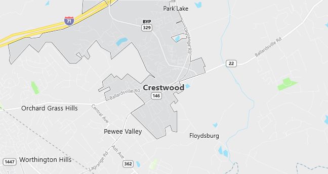
Moving to Crestwood, Kentucky
Population: 1,999. Estimated population in July 2024: 2,250 (+12.6% change)
Males: 946 (47.3%), Females: 1,053 (52.7%)
Zip code: 40014
Demographics
Median resident age: 35.0 years
Median household income: $42,619
Median house value: $116,700
Population by Race
Races in Crestwood:
- White Non-Hispanic (92.6%)
- Hispanic (3.2%)
- Black (2.2%)
- Other race (1.1%)
- Two or more races (1.0%)
- American Indian (0.7%)
Ancestries: German (20.8%), Irish (15.8%), English (15.7%), United States (14.8%), Italian (2.5%), French (2.2%).
Land area: 3.6 square miles
Population by Education
For population 25 years and over in Crestwood
- High school or higher: 83.5%
- Bachelor’s degree or higher: 24.2%
- Graduate or professional degree: 7.9%
- Unemployed: 5.4%
- Mean travel time to work: 20.6 minutes
For population 15 years and over in Crestwood city
- Never married: 24.0%
- Now married: 53.9%
- Separated: 1.4%
- Widowed: 6.3%
- Divorced: 14.5%
2.6% Foreign born (0.9% Asia, 0.9% Latin America, 0.3% Europe).
Population change in the 1990s: +382 (+23.6%).
Hospitals
Hospitals/medical centers near Crestwood:
- CENTRAL STATE HOSP (about 7 miles; LOUISVILLE, KY)
- TEN BROECK HOSP (about 9 miles; LOUISVILLE, KY)
- BAPTIST HOSPITAL NORTHEAST (about 9 miles; LA GRANGE, KY)
Airports
Airports certified for carrier operations nearest to Crestwood:
- LOUISVILLE INTL-STANDIFORD FIELD (about 21 miles; LOUISVILLE, KY; Abbreviation: SDF)
- BLUE GRASS (about 65 miles; LEXINGTON, KY; Abbreviation: LEX)
- COLUMBUS MUNI (about 70 miles; COLUMBUS, IN; Abbreviation: BAK)
Other public-use airports nearest to Crestwood:
- BOWMAN FIELD (about 14 miles; LOUISVILLE, KY; Abbreviation: LOU)
- CLARK COUNTY (about 18 miles; JEFFERSONVILLE, IN; Abbreviation: JVY)
- HOLIDAY INN LAKEVIEW (about 19 miles; CLARKSVILLE, IN; Abbreviation: 1I6)
Amtrak station near Crestwood:
- 19 miles: LOUISVILLE/JEFFERSONVILLE (JEFFERSONVILLE, 500 WILLINGER LANE). Services: enclosed waiting area, public payphones, snack bar, taxi stand, intercity bus service.
Colleges and Universities
Colleges/universities with over 2000 students nearest to Crestwood:
- SULLIVAN UNIVERSITY (about 16 miles; LOUISVILLE, KY; Full-time enrollment: 2,342)
- BELLARMINE UNIVERSITY (about 16 miles; LOUISVILLE, KY; Full-time enrollment: 2,030)
- UNIVERSITY OF LOUISVILLE (about 17 miles; LOUISVILLE, KY; Full-time enrollment: 15,514)
- JEFFERSON COMMUNITY COLLEGE (about 20 miles; LOUISVILLE, KY; Full-time enrollment: 5,290)
- INDIANA UNIVERSITY-SOUTHEAST (about 24 miles; NEW ALBANY, IN; Full-time enrollment: 4,355)
- ELIZABETHTOWN COMMUNITY COLLEGE (about 51 miles; ELIZABETHTOWN, KY; Full-time enrollment: 2,217)
- UNIVERSITY OF KENTUCKY (about 71 miles; LEXINGTON, KY; Full-time enrollment: 20,492)
Schools
Public high school in Crestwood:
- SOUTH OLDHAM HIGH SCHOOL (Students: 997; Location: 5900 HWY 329 BYPASS; Grades: 09 – 12)
Private high school in Crestwood:
- UNITED CHRISTIAN ACADEMY (Students: 14; Location: 6415 A RAILROAD AVE; Grades: 9 – 12)
Public primary/middle schools in Crestwood:
- CAMDEN STATION ELEMENTARY SCHOOL (Students: 801; Location: 6401 W HWY 146; Grades: KG – 05)
- SOUTH OLDHAM MIDDLE SCHOOL (Students: 766; Location: 6403 W HWY 146; Grades: 06 – 08)
- CRESTWOOD ELEMENTARY SCHOOL (Students: 676; Location: 6500 W HWY 146; Grades: KG – 05)
- CENTERFIELD ELEMENTARY SCHOOL (Students: 619; Location: 4512 S HWY 393; Grades: KG – 05)